April 10, 2026
Global Mapper® 27 introduces a major update with the integration of GeoCalc, Blue Marble’s industry-standard geodetic library, directly into the platform.
This brings advanced geodetic capabilities into a single environment, eliminating the need for separate tools and enabling more accurate, efficient geospatial workflows. From coordinate transformation to terrain modeling and lidar validation, teams can now complete more of their work within Global Mapper, reducing complexity while improving consistency and reliability.
Advanced Geodetics Without Complexity
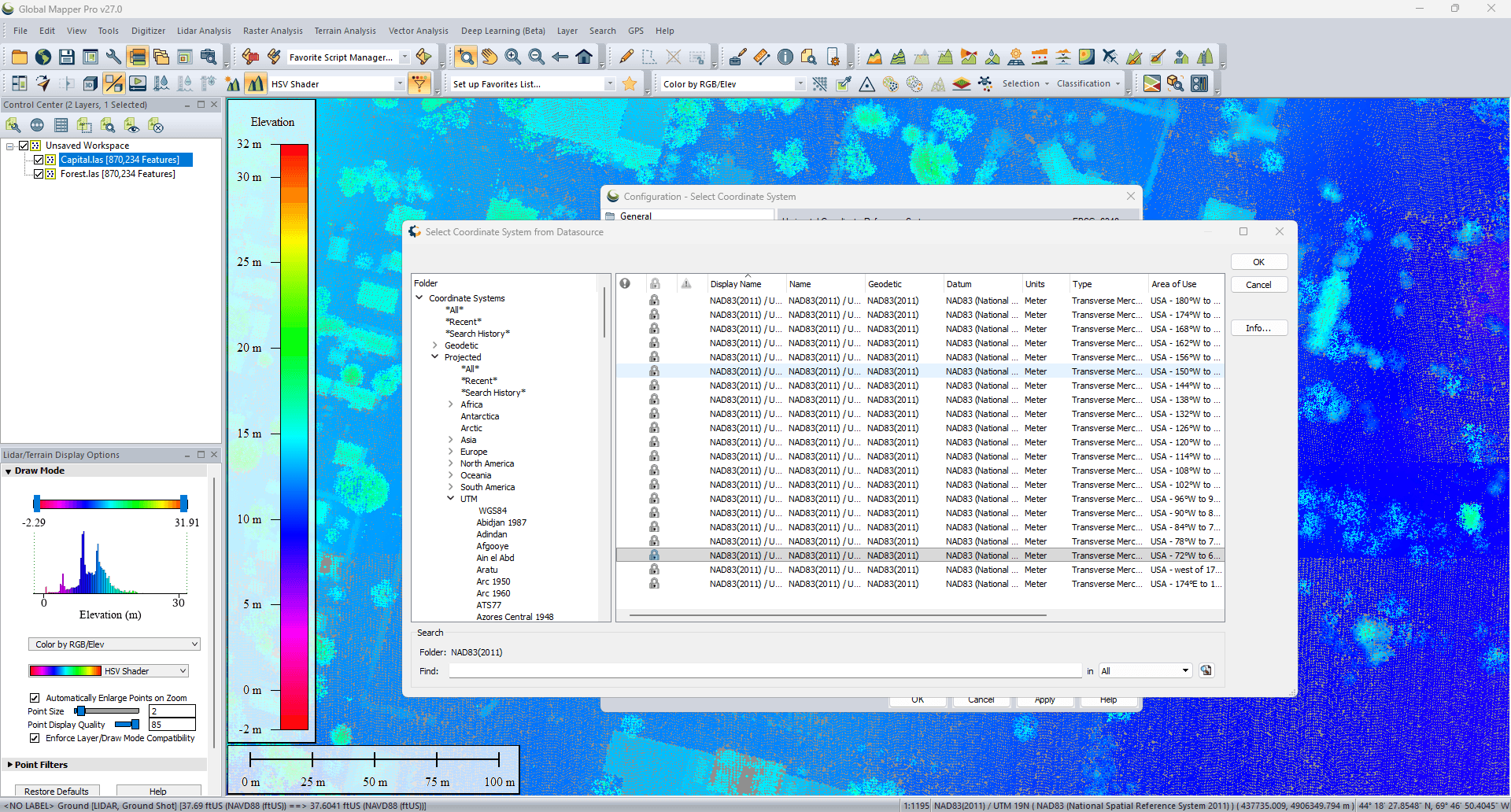
With GeoCalc now directly integrated into Global Mapper, highly accurate coordinate transformations can now be performed within a single workflow. This reduces the need for external geodetic tools and ensures greater consistency across projects.
GeoCalc enables handling of coordinate systems, datums, and transformations to published standards, which is critical for workflows where even small inaccuracies can impact downstream analysis, compliance, and decision making.
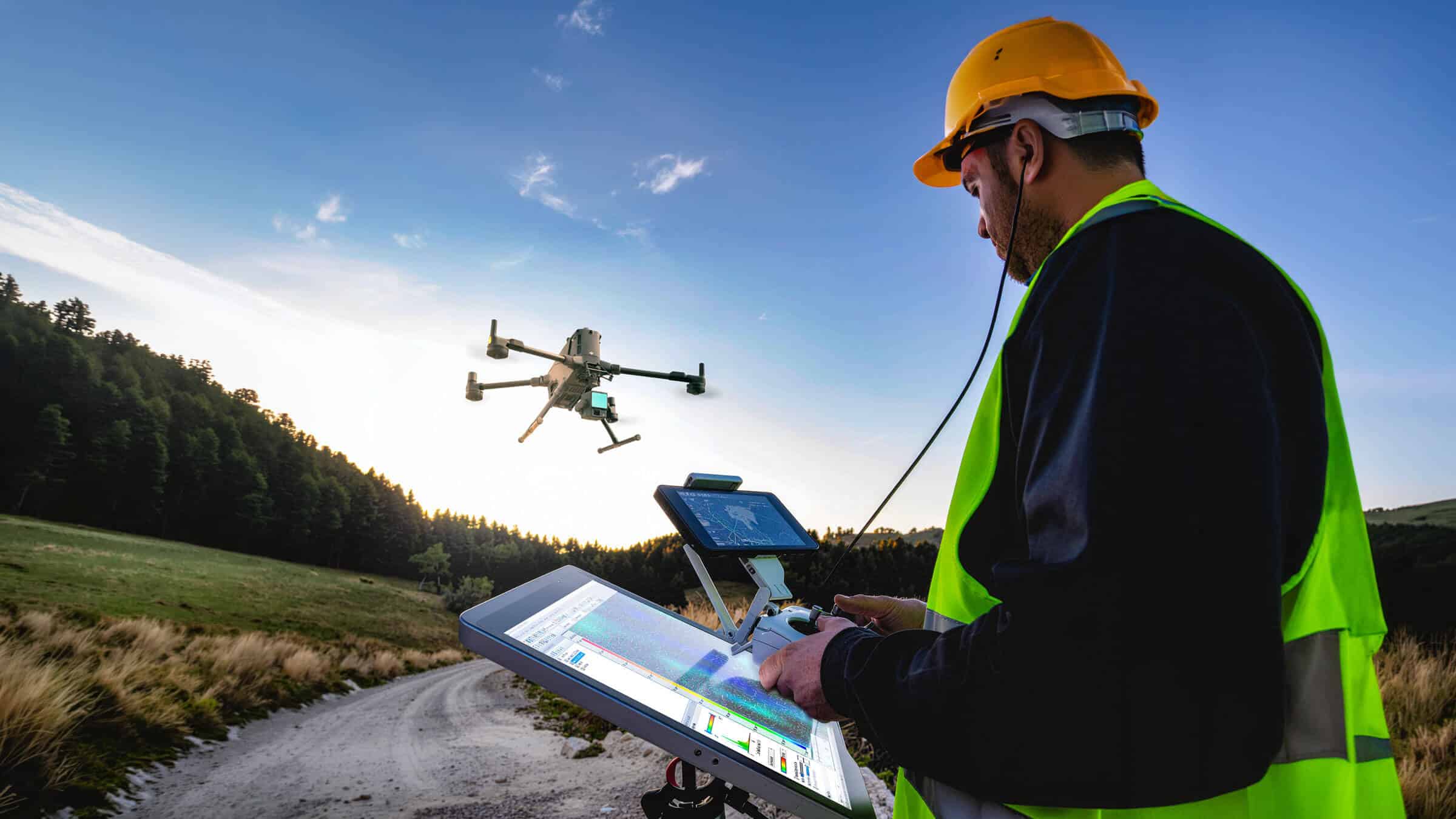
Validate Aerial Lidar and Positional Accuracy
Global Mapper 27 introduces advanced horizontal quality assurance capabilities for professionals working with point cloud data. These tools improve adjacent flight path alignment, refine ground control point accuracy, and strengthen overall quality control.
The result is more reliable point cloud data and greater confidence in every deliverable, particularly for workflows that require strict adherence to accuracy standards.
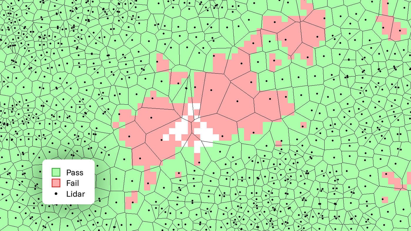
Meet Evolving Data Standards Across Every Delivery
Global Mapper 27 includes built-in ASPRS density measurement methods to help ensure compliance with evolving industry standards. These capabilities reduce risk and streamline validation across every delivery, enabling teams to confidently meet required specifications without adding manual overhead.
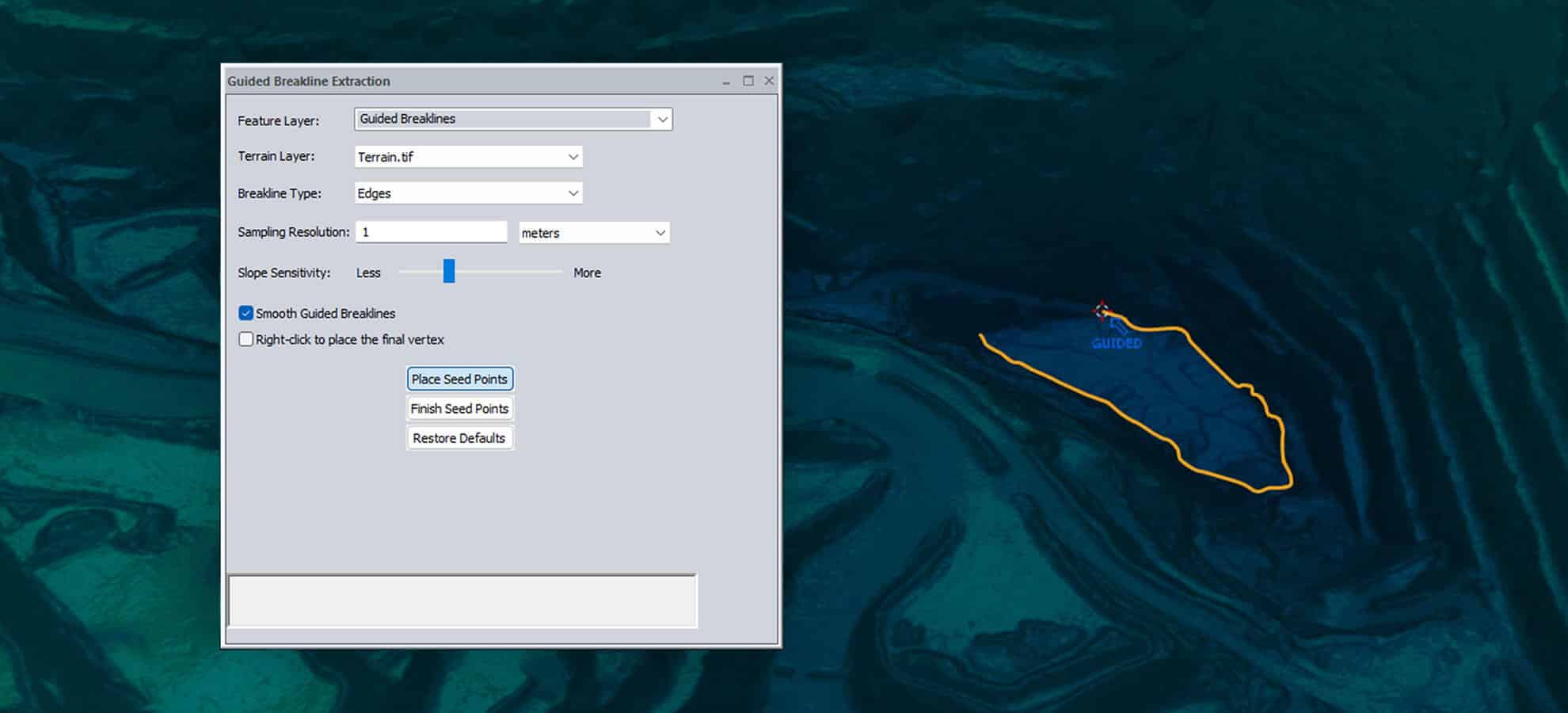
Optimize Breakline Creation With Intelligent Automation
Global Mapper 27 improves terrain modeling workflows with guided breakline extraction. By reducing the need for manual digitizing, these capabilities enhance consistency and accuracy across terrain models while accelerating production.
Reduce Friction Across Your Workflow With Broader Format Support
Expanded format support in Global Mapper 27 enables more seamless interoperability across systems and workflows. With enhancements including E57 export, LAS 1.5 support with GPS time offsets, direct TFADS-O export, and GGF export for GNSS workflows, teams can reduce conversion steps and maintain data integrity throughout the lifecycle of their projects.
Get Started with Global Mapper 27
Global Mapper 27 delivers the accuracy, consistency, and efficiency required for modern geospatial workflows. Whether validating aerial lidar, meeting evolving data standards, or accelerating production with automation, it enables teams to complete more of their workflows within a single environment.
By reducing fragmentation and bringing critical capabilities together, Global Mapper helps teams focus on delivering accurate, reliable results in real-world conditions. Learn more about v27 by viewing the free on demand course titled “Geodetics and Coordinate Management in Global Mapper“.
Explore what’s possible with Global Mapper 27 by upgrading or starting a free trial.