March 18, 2026
Experience desktop-grade reliability directly from your browser with Geographic Calculator® Cloud 1.1. Designed to process massive vector and raster datasets either locally or in the cloud, this platform delivers high-performance processing while enabling seamless collaboration for remote and distributed teams.

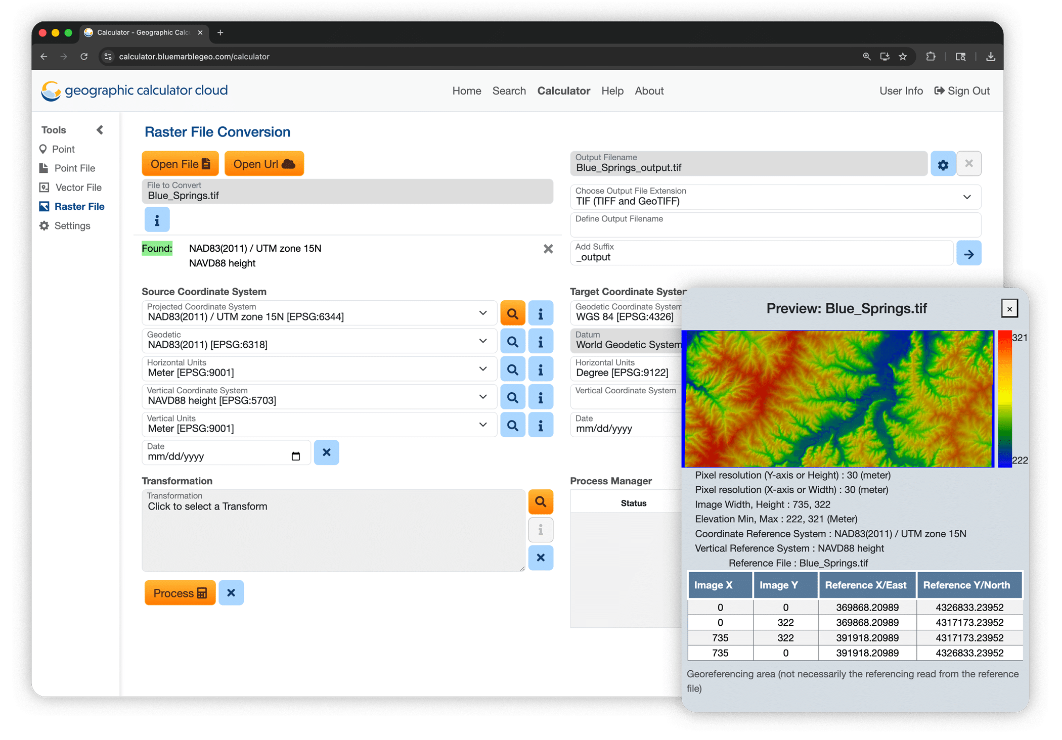
Powerful Raster Processing Capabilities
Version 1.1 introduces raster processing to Geographic Calculator Cloud’s toolset. Designed to simplify the management and transformation of large raster datasets, this change enables users to efficiently process imagery and elevation data while maintaining the precision and reliability for which Geographic Calculator is known. This capability helps teams handle complex raster transformations directly in the cloud, reducing the need for local processing resources and enabling faster, more scalable workflows.
Extensive Support for Custom Coordinate Systems & Transformations
Geographic Calculator Cloud now provides extensive support for custom coordinate systems and transformations, allowing users to configure and apply specialized geodetic parameters from their browser with ease. This flexibility ensures that organizations can maintain consistency with established workflows while leveraging the scalability and accessibility of a cloud-based environment.
Enhancements to the Point File Workflow
Geographic Calculator Cloud 1.1 also introduces major enhancements to the Point File workflow, making it easier to manage and process tabular (spreadsheet) coordinate data. Improved handling of point datasets means that users can upload, transform, and validate large volumes of coordinate information more efficiently. These enhancements streamline everyday geodetic tasks and provide greater confidence when working with critical spatial data.
Scale Your Geodetic Data Projects
With the release of Geographic Calculator Cloud 1.1, organizations can scale their geodetic data projects with the reliability and precision professionals trust from Geographic Calculator—now delivered through the accessibility of the cloud. By combining high-performance processing, enhanced workflows, and flexible coordinate system support, Geographic Calculator Cloud empowers teams to process complex geospatial data more efficiently and collaborate from anywhere.
Scale your geodetic data projects: Explore Geographic Calculator Cloud 1.1!
