Classifying Point Clouds with the Push of a (few) Button(s)!
December 19, 2023If you are working with any type of point cloud data, Global Mapper Pro is a powerful, must-have software. One of the standout features is its ability to automatically identify and apply the appropriate ASPRS classification to each point with a few clicks. This blog will walk through the basic steps required to automatically classify a point cloud.
Global Mapper Pro’s Point Cloud Analysis tool provides the means to classify a point cloud, including built-in automatic tools for identifying ground, buildings, utility lines and poles, vegetation, and noise points within an unclassified point cloud. There are multiple methods available for these classifications, including gridded and segmentation-based. You can read more about them in this blog that details the release of the new point cloud processing tools.
To identify other unique features in the point clouds outside of the built-in classifications, you can train a custom classification tool by following these steps.
Quick Look at the Automatic Point Cloud Analysis Tool
As of version 25, all point cloud classification tools are found in the Automatic Point Cloud Analysis tool. Looking at the tool, you can see there are multiple collapsable sections separated based on function. Here’s a basic introduction:
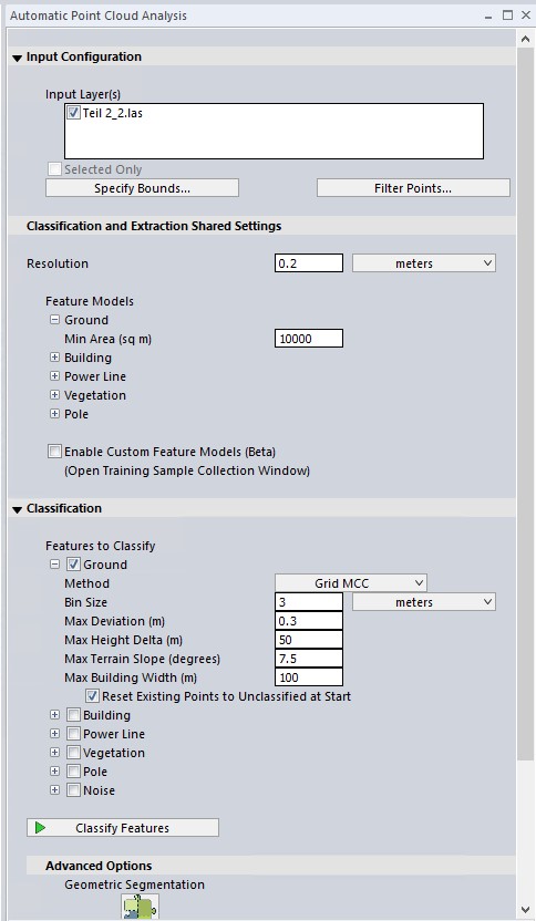
- Input Configuration – Choose which point cloud(s) to process along with any other bounds settings. These apply to all tools in the Point Cloud Analysis window.
- Classification and Extraction Shared Settings – These settings apply to both Classification and Extraction tools. They are in a shared location to avoid duplication.
- Classification – These are the automatic classification tools. Check one or multiple boxes to identify those points in your point cloud.
- Advanced Options: Segmentation – A manual way of point cloud classification that separates the cloud into clusters based on shared structure and characteristics.
- Extraction – create vector features, such as line and area features, from your classified point cloud.
Color Point Cloud by Classification
When you load a point cloud into the software, the color of the points is determined by the Color Lidar by dropdown menu. Points can be displayed using several different attributes, including elevation (default), intensity, and classification. For this process, we will color the Lidar by classification. If your point cloud has never been classified, it will look similar to this:
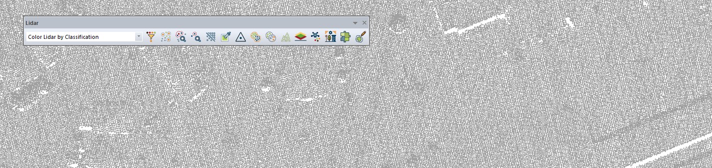 Unclassified points are displayed as gray when using Color by Classification.
Using the Automatic Classification tools
To use a classification, check the box and click Classify Features. You can run one or many at once.
Recommended Order:
The classification tools are loosely made to run in a specific order: noise, ground, buildings and vegetation, powerline, and finally, power pole. This will automatically be applied when you check multiple classifications to run at once. The order is important because the tools look for data that has already been classified. For example, the building and vegetation classification tools look for points at a certain distance above the ground.
Method:
Gridding, also called MCC, is the original legacy method. Lidar used to be predominantly gathered by fixed-wing aircraft, and that’s the type of data that this method is built to analyze. Gridding has been largely superseded by the Max Likelihood method.
Max Likelihood is a segmentation-based method. For each classification type, the tool has been tailored to find clusters of points that have the common shapes and characteristics of these features in the point cloud. While the Max Likelihood methods have fewer settings than the Grid methods, there are additional options available in Shared Settings.
*Tip: It’s often easiest to first run the default settings, then look at your data to see what hasn’t been captured and adjust the settings to meet those needs. Each classification has its own page in the Knowledge base with more information on settings definitions and more.
Noise Classification
Noise classification identifies outliers that might negatively influence the other classifications. Typically, noise points are artifacts in the data that don’t represent real features, such as birds, rain, or reflections off of water or windshields. These points are often too high or too low, causing errors in other classifications.
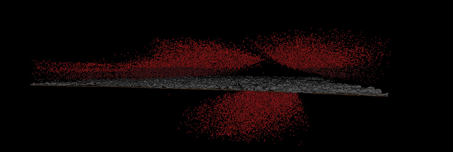 Now that these rain points are classified as noise, they will not impact future classifications.
Ground Classification
Ground classification is an intelligent tool that works to classify ground points apart from other features, especially vegetation. The settings can be adjusted based on the local terrain, the range of elevation values in the data set, or known features in the landscape. For settings tips see Troubleshooting Lidar Ground Classification. The dialog is different, but the settings values are the same.
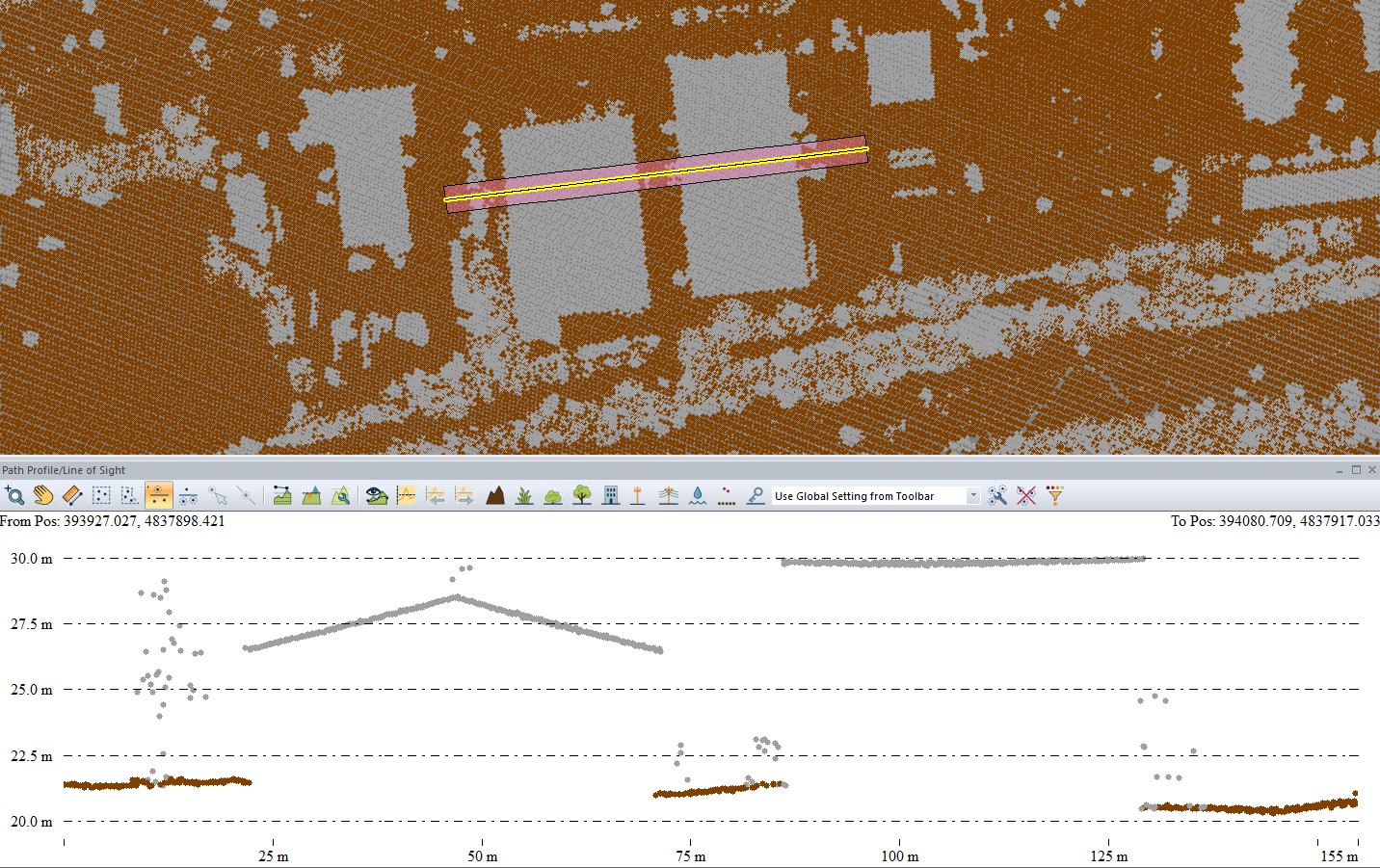 A point cloud with classified ground points.
Building Classification
The parameters required in the classification process describe the expected structure of buildings within the point cloud. These values can be adjusted to account for the characteristics of your specific point cloud to help distinguish large buildings from elevated ground, etc.
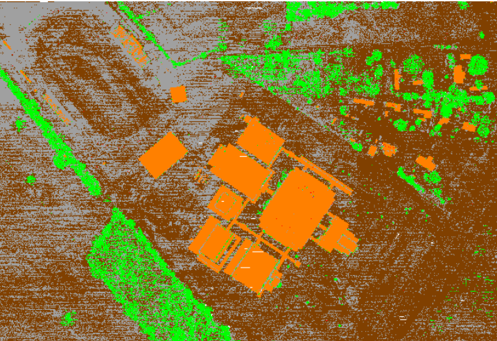
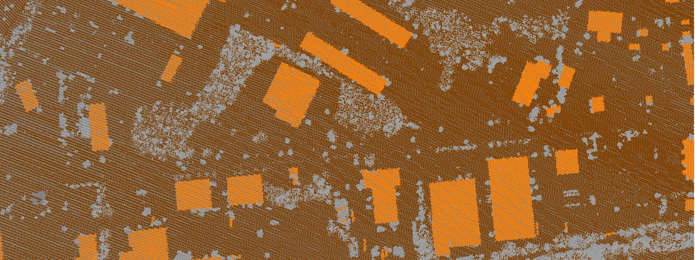 Buildings classified in an urban environment.
Vegetation Classification
This tool seeks vegetation of all types. If you are using the option to classify trees by height, be sure to scroll up and check the Classification and Extraction Shared Settings to specify the height thresholds. More information can be found in the Knowledge Base.
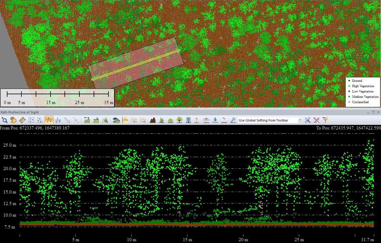 Vegetation can be assigned different classifications based on height.
Power pole
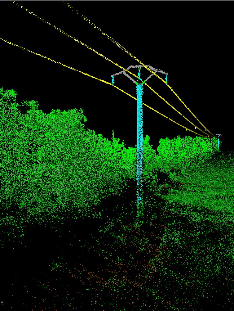
This tool identifies cylindrical objects and/or pole-like objects, such as utility poles, in the point cloud. As poles are vertical structures, this works best with oblique or terrestrial data/. For more tips see: Classifying Power Poles with the New Segmentation Option in Global Mapper
For information on classifying non-cylindrical poles, check out this other blog on Transmission Towers.
Power lines
This tool looks for linear objects. Functionally, it automatically detects above-ground cables in high-density Lidar data with at least 20 points /m2. Lower density point clouds often do not typically have the reconstruction detail to include these narrow line features.
Looking for more?
After you have classified your point cloud, you can begin analyzing the data further. This may involve creating a terrain model or extracting vector features from the classified point cloud.
More Lidar Resources:
- Improving the Quality of Lidar Data in Global Mapper
- Lidar Quality Control in Global Mapper Pro
- Creating a Digital Terrain Model in Global Mapper Pro
- How to Classify Lidar in the Path Profile View
- How to Create Custom Point Cloud Classes
- Train Custom Lidar Classifications
To learn more about Global Mapper Pro’s automatic classification tools, please check out the Global Mapper Knowledge Base and if you have any further questions about the auto-classify tools, please contact our technical support team.


