Success Story
29 Parks. 52,000 Acres. One Authoritative Map Source.
Snapshot

Client:
Santa Clara County Department of Parks and Recreation

Challenge:
Getting accurate, up-to-date maps into the hands of both park visitors and field staff across a sprawling county park system

Outcome:
Authoritative maps delivered across 29 parks, reducing paper distribution while keeping visitors and field staff aligned on the same current information source
Project overview
Government agencies responsible for parks, public lands, and natural resources depend on authoritative maps to guide field operations and inform the public. Keeping those maps current across large geographic areas has traditionally relied on printed materials that are costly to update, difficult to distribute, and quickly become outdated. Success depends on delivering authoritative GIS maps to both field staff and the public from a single, trusted source.
This success story explores how the Santa Clara County Department of Parks and Recreation used Avenza Maps to create a connected office-to-field workflow across 29 parks and more than 52,000 acres. By replacing paper distribution with digital map delivery, the department improved access to current maps, streamlined updates, and ensured visitors and staff worked from the same authoritative geographic information.
The challenge
Park maps need to reach two very different audiences: members of the public arriving at a trailhead, and rangers and staff working across the park system. Paper maps served neither well. They were costly to update, slow to distribute, and generated waste. Staff lacked a reliable way to access current maps in the field, and visitor maps were often outdated by the time they were posted or stocked.
The department needed a scalable way to distribute authoritative maps, keep them current, and provide reliable access for both visitors and field staff.
The approach
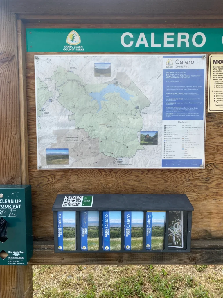
GIS Analyst Seth Hiatt and his team prepared georeferenced park maps in the office, packaging them for deployment directly to mobile devices. QR codes posted at trailheads and trail centers give visitors instant access to the correct map for their location. The same authoritative maps made available to visitors are also used by park staff in the field to document safety concerns, natural resources observations, and locations of interest, ensuring everyone is working from the same geographic reference.
Office-to-field map distribution workflow
Using Avenza Maps, Blue Marble’s field suite, the Parks and Recreation team created a single map distribution workflow connecting office preparation to field access.

Prepare Authoritative Maps
GIS staff prepared georeferenced park maps in the office and packaged them for mobile deployment.


Deliver Maps Digitally
QR codes at trailheads and visitor centers allowed visitors to download the correct map for their location.

Support Field Operations
Rangers and field staff accessed the same authoritative maps for navigation, inspections, safety observations, and operational documentation.

Publish Updates
Map updates made in the office became available without reprinting, manual redistribution, or outdated paper inventories.

Maintain One Source of Truth
Visitors and staff relied on the same authoritative GIS maps, reducing confusion and improving consistency across the park system.
Results
Deploy authoritative maps across your entire operation
Deliver authoritative GIS maps from the office to visitors, field staff, and stakeholders through a single connected workflow.

Purchase now
Instantly equip your team with the tools they need to turn geospatial data into real-world outcomes.

Try for free
Explore the full platform with your own data before choosing the plan that’s right for you.

Request a demo
Discuss your workflows with a geospatial expert and find the right solution for your team.