Success Story
From Crash Scene to Courtroom. In Under an Hour.
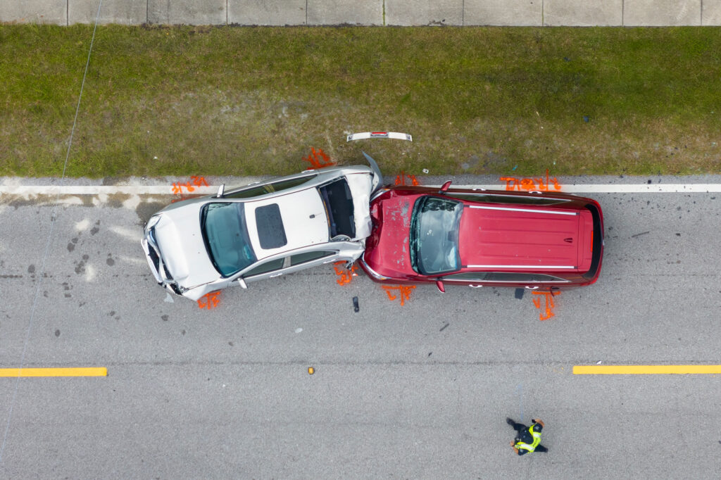
Snapshot

Client:
Windham, ME Police Department

Challenge:
Documenting and analyzing crash sites and crime scenes with precision, speed, and evidentiary integrity

Outcome:
Scene processing time reduced from 2+ hours to 30-45 minutes; 3D visualizations used directly in court proceedings
Project overview
Emergency response agencies must document incident scenes quickly without compromising evidentiary accuracy. Every additional minute spent collecting measurements affects public safety, traffic flow, and investigative resources. Success depends on capturing defensible spatial data in the field and transforming it into reliable evidence that investigators and courts can trust.
This success story explores how the Windham Police Department used Global Mapper to build a connected field-to-office workflow that combined drone imagery, ground control points, and photogrammetry to generate accurate 3D scene reconstructions. By accelerating processing while maintaining evidentiary integrity, the department reduced scene documentation time, improved investigative workflows, and produced courtroom-ready visualizations in a fraction of the time required by traditional methods.
The challenge
Forensic scene documentation demands accuracy that holds up under legal scrutiny. For years, Windham PD relied on total stations and manual surveying methods that required lengthy scene closures, labor-intensive data collection, and hours of office processing before investigators could begin analysis. The longer a crash site remains closed, the greater the impact on public safety, traffic flow, and department resources. The department needed a faster path from scene capture to analysis without compromising precision or defensibility.
The approach
Detective Eugene Gallant and Captain Jason Burke developed a drone-based documentation workflow using Global Mapper to rapidly capture crash scenes and crime scenes. Ground control points established precise spatial reference in the field, while office-based processing transformed imagery into accurate 3D models and courtroom-ready evidence.
Field-to-office workflow
Using Global Mapper, the Windham Police Department created a connected field-to-office workflow that transformed drone imagery into accurate 3D scene reconstructions, accelerating crash scene documentation while producing courtroom-ready evidence.

Capture the Scene
Drone imagery was collected across the incident area, while ground control points established accurate spatial reference for reconstruction.


Validate Spatial Accuracy
Ground control points and reference measurements were verified to ensure geometric accuracy before processing.

Generate 3D Evidence
Global Mapper’s Pixels to Points photogrammetry tool produced dense point clouds, orthomosaics, and detailed 3D scene reconstructions for investigation and courtroom presentation.

Support Investigations
Measurements, annotations, and visualizations were prepared for investigators and courtroom presentation.
Results
Accelerate emergency response with a connected field-to-office workflow
Capture incident scenes in the field, generate defensible spatial evidence in the office, and move from response to investigation faster.

Purchase now
Instantly equip your team with the tools they need to turn geospatial data into real-world outcomes.

Try for free
Explore the full platform with your own data before choosing the plan that’s right for you.

Request a demo
Discuss your workflows with a geospatial expert and find the right solution for your team.


