Vector Data Conversions
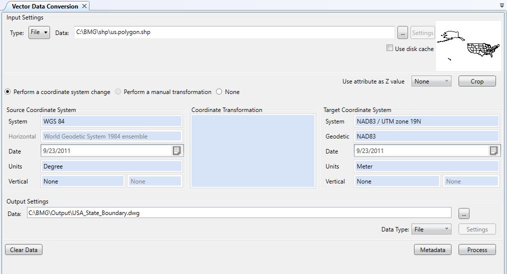
The Vector Data Conversion Job performs file format translation and coordinate system conversions upon many vector file formats. This section contains several topics covering many aspects of the Vector Data Conversion Job, including:
-
Quick Start - Vector Data Conversion - A brief guide to help you perform your first vector data conversion.
-
Performing Vector Data Conversions - An overview of the user interface provided for the Vector Data Conversion Job, and a discussion of how to use it.
-
Crop Area and Layers - A guide to cropping area and splitting layers in a Vector Data Conversion.
-
Vector Scale, Translate and Rotate - A guide to performing scale, translation and rotation on the Vector Data Conversion job.
-
Batch Vector Data Conversions - An overview of how to perform several Vector Data Conversions in a Batch.
-
Vector Read Formats - A listing and description of all vector data file formats that can used as input for a conversion.
-
Vector Write Formats - A listing and description of all vector data file formats that can be used to store the output of a conversion.
If you have a vector file without internal referencing, or in an unknown coordinate system, you can use the Georeferencer to create a fitted system for that file.
If you are interested in reading from and writing to Spatial Databases, see the Spatial Databases section of the help files.
Click on any of the items in the screenshot below for more information.