Spatial Databases with Vector Data Conversions
The Vector Data Conversion Job Interface allows users to select Spatial Database data as well as File data for either Input or Output data. To work with a Spatial Database, select the desired Spatial Database Type from the dropdown.
Note: Spatial database connections that support vector data are all in the 32-bit application.
Clicking Browse will bring up the Select a Database Connection... dialog. The appearance of this dialog may change depending on the type of Spatial Database. For PostGIS spatial databases the dialog will look like this:
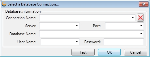
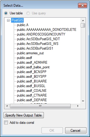
Clicking Test will run a process to attempt to connect to the specified Spatial Database. This is not a required step. Clicking OK will create the connection, and will bring up a Select Data... dialog listing the available tables in the specified Spatial Database.
Note: In order to save out converted Vector Data, the output table (if it exists) will be completely overwritten with the newly converted data. By default, the Geographic Calculator defaults to disallowing an overwrite of an existing table. This setting can be configured on the Administrative Settings form. See Locking Spatial Databases for more information.