Global Mapper can composite imagery into a multi-band image during export, or by using the Raster Calculator tool.
The Set up Bands for Export dialog also appears in various other tools that involve input or output of multi-band rasters, such as Raster Calculator, Pan Sharpen Imagery, and Apply Color to Lidar Points.
- To create a multi-band image, export to a raster/ image format that supports multiple bands, such as GeoTIFF, BIL, RAW, NITF or MrSID formats.
- Load the raster data that will be combined into a single multi-band image.
- Navigate to File > Export > Raster / Image Format...
- In Select Export Format, choose a format that supports multi-band imagery
-
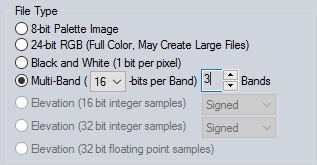
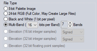
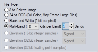
In the File Type section of the Export Options, choose Multi-Band, and specify the number of bits per Band and the number of Bands to include in the output.
-
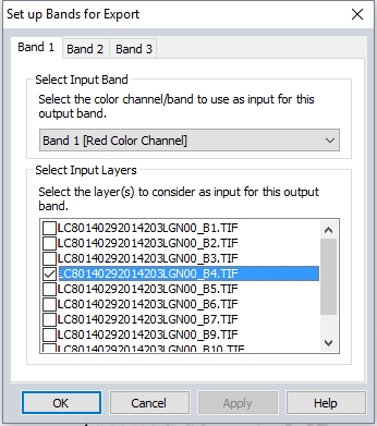
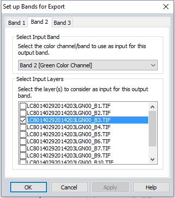
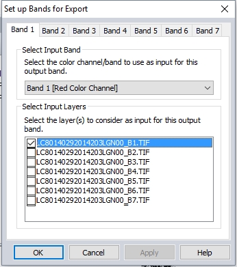
The Set up Bands for Export dialog will appear. Specify which Layer to include in Band 1. Then choose which color channel/ band within that layer will be included in the output band.
-
Set up the Layer and color channel / band to include in each of the output bands
This example loads a *.tar.gz file downloaded from Earth Explorer by connecting to the online source IMAGERY > Landsat 8 Global Imagery
To simplify the export, only the relevant bands are turned on in the Control Center. In this example, only Band 1 - Band 7 will be combined.

In the export options, the File Type is set to Multi-Band for 7 Bands.
In each band set-up tab, the relevant layer is selected and other layers are deselected. Since these input images are single band / grayscale, the input color channel / band does not matter. The red, green and blue channels are all using the same reflectance value.
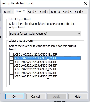
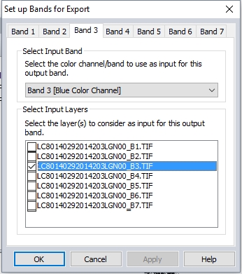
This process is repeated for each output band.
The resulting file contains a 7-band multi-spectral image. For more information on loading and setting up the display of a multi-band image, see Band Setup Tab and Color/ Contrast Adjustment.
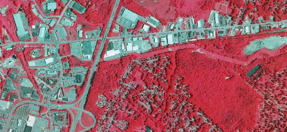
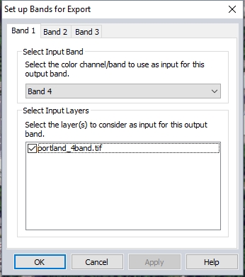
This example takes a 4-band aerial image with RGBI values, and exports a 3-band false color image (4,1,2).
Note: with a 3-band image, you can also export the visible bands selected in the Band Setup Tab to any raster format and achieve the same result.
In the Export Options dialog, the File Type is set to Multi-Band with 3 Bands.
On the band set up dialog, the Input for Band 1 is set to Band 4 (NIR).
The inputs for Band 2 and 3 are also set to the appropriate bands.
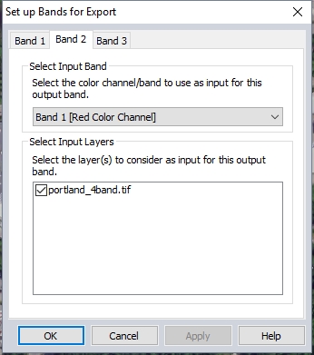
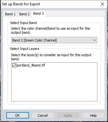
The resulting image will be a false color infrared image, using NIR, Red, and Green as the color channels.