In Vector Jobs, the Format button is used for selecting the formatting options for your input and output coordinates. The Format button will open the Unit Display Settings menu.
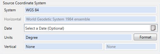
The type of units selected is defined using the Units picker; most frequently, this menu will be used for formatting Degrees. Depending on the type of units being defined (linear or angular), the Format button will bring up a different panel of the Unit Display Settings menu.
Example
For example, if you have coordinates in decimal degree format that need to be converted to Degrees Minutes Seconds format, you would choose the two separate formats for your input and output using the drop down menus on the Geodetic Coordinates tab.

The Example area at the bottom of the Unit Display Settings menu will change interactively as you select different formatting options to help illustrate how your format options will affect the display of your coordinates.
Supported Formats
You can enter latitude and longitude degree coordinate values into the Geographic Calculator in many formats, not only decimal degrees. The formats that you can select are shown below with an example (all examples represent the coordinate: South 44 degrees, 30 minutes, 15 seconds):
- Signed Grid (UTM, State Plane, etc.) or Degrees (examples: -44.50416, 146.84028)
- Degrees and Direction (examples: 44.50416S, 146.84028E)
- Signed Degrees and Minutes (examples: -44 30.24960, 146 50.41680)
- Degrees, Minutes, and Direction (examples: 44 30.24960S, 146 50.41680E)
- Signed Degrees, Minutes, and Seconds (examples:-44 30 14.97600, 146 50 25.00800).
- Degrees, Minutes, Seconds, and Direction (examples: 44 30 15.000S, 146 50 25.00800E)
- DM (examples: -44.3024960, 146.5041680)
- DMS (examples: -44.301497600, 146.502500800)
- Packed DMS without decimal (examples: -443024960, 1465041680)
- Packed DMS with decimal (examples: -443014.97600, 1465025.00800)
- Packed DM with decimal (examples: -4430.24960, 14650.41680)
- Brazil ANP (example: -44:30:15,000)
- The direction (N/S/E/W) can be entered as either a prefix or suffix.
Reference East coordinates are positive to the east (and increase to the east) and represent either longitude or grid easting values within the Geographic Calculator. Reference North coordinates are positive north (and increase to the north) and represent either latitude or grid northing values.
Note: In the Western Hemisphere you must indicate the sign for geodetic longitude values or apply a "W" direction indicator, for example "-69 30 15.0 or 69 30 15.0 W". In the Southern Hemisphere you must indicate the sign for geodetic latitude values or apply an "S" direction indicator, for example "-45 30 15.0 or 45 30 15.0 S". Otherwise, the latitude/ longitude values will be assumed to be in the eastern or northern hemispheres, respectively.
Other Unit Settings
For more information about Linear Decimal Precision, Angles, DLS Descriptions, and Scalar units see Default Unit Display Settings
Set As Default
The Set As Default button will save the format that you have selected for the Left Format. This format will become the default setting for both the left and right side in new jobs.
Once you have set the format for the left and right sides of the screen, click OK to close the window and return to the job.