Default Unit Display Settings
You can specify default unit display settings including format and precision (number of decimal places) for calculated values by selecting Options > Preferences. On the General panel, click the Customize Unit Display Settings button.
An example is displayed at the bottom of the window based upon the settings chosen for that particular option. It is possible to set a different precision for each particular option, as well. Thus, grid coordinates can be set to five decimal places, while lat/long degrees can be set to two decimal places. This allows for greater flexibility.
Note that a version of this dialog will be also displayed when the user clicks the Unit Format Button within a job. In that case, however, the settings apply only to that specific job. There will be additional options to set the left and right side formats independently, as well as a Set As Default button that will save the Left format as the default.
Geodetic Coordinates
You can specify the display format, precision, direction prefix/suffix
option, and symbols option for calculated latitude and longitude degrees
coordinate values within the Geodetic Coordinates panel.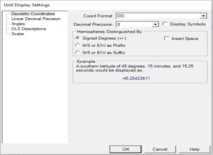
Decimal Degrees Display Format (listed below)
This option allows the user to specify the number of decimal places of precision to be displayed for the calculated(i.e. Output) point.
For example, if the user is converting to a Geodetic (i. e. Lat/Long) coordinate system and specifies “3” for display precision, the result will be displayed with three decimal places of precision.
Example:
Assume the user has chosen to display the Angular Unit Format as DD MM SS.
N 45 30 22.123
W 110 23 46.123
CAUTION: If this result is used to ‘back calculate’ the coordinate to the INPUT coordinate system, there MAY be a loss of precision (READ: the position may shift due to rounding errors).
If multiple conversions are needed, it is best to specify a higher number of decimal places. More decimal does not imply greater accuracies; it just reduces ‘rounding’ errors in the calculations.
There are many possible display formats for geodetic coordinates (latitude/longitude). The formats that you can select are shown below with an example (all examples represent the coordinate: South 44 degrees, 30 minutes, 15 seconds):
-
DD. (example: -44.50416 or 44.50416 S)
-
Packed DMS(example: -44301500 or 44301500 S)
-
Packed DM. (example: -4430.2500 or 4430.2500 S)
-
Brazil ANP (example: -44:30:15,000 or 44:30:15,000 S)
Linear Decimal Precision
This option allows the user to specify the number of decimal places
of precision to be displayed for a number of different linear values,
including Grid Coordinates, Elevations, Distances, and Geocentric Coordinates.
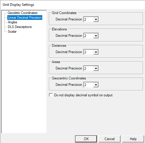
Example: If the user is converting between vertical datums and specifies “3” for Elevations decimal precision, the result will be displayed with three decimal places of precision.
Elevation: 1234.123
CAUTION: If this result is used to ‘back calculate’ the coordinate to the INPUT coordinate system, there MAY be a loss of precision; the position may shift due to rounding errors.
If multiple conversions are needed, it is best to specify a higher number of decimal places. More decimal places does not imply greater accuracies; it just reduces ‘rounding’ errors in the calculations
The Check box named Do not display decimal symbol on output will remove the decimal marker from your output points. This is used when our output points have an implied decimal. This does not omit the decimal precision, it only omits the decimal symbol, so 1234.123 will instead display as 1234123.
Angles
You can specify the display format, precision,
and symbols option for calculated angle values within the Angles panel.
There are many possible display formats for angle values in the degrees unit measure. The formats that you can select are shown below with an example (all examples represent the coordinate: 44 degrees, 30 minutes, 15 seconds):
-
DD. (example: 44.50416)
-
DD MM. (example: 44 30.2500)
-
DD-MM. (example: 44-30.2500)
-
DD MM SS. (example: 44 30 15.000)
-
DD-MM-SS. (example: 44-30-15.000)
-
DD.MM (example: 44.3025)
-
DD.MMSS (example: 44.3015)
-
Packed DMS(example: 44301500)
-
Packed DMS. (example: 443015.00)
-
Packed DM. (example: 4430.2500)
DLS Descriptions
You can specify the Point Data Version, String
Display Order, Linear Units, and Road Allowance Handling within the DLS
Descriptions panel. 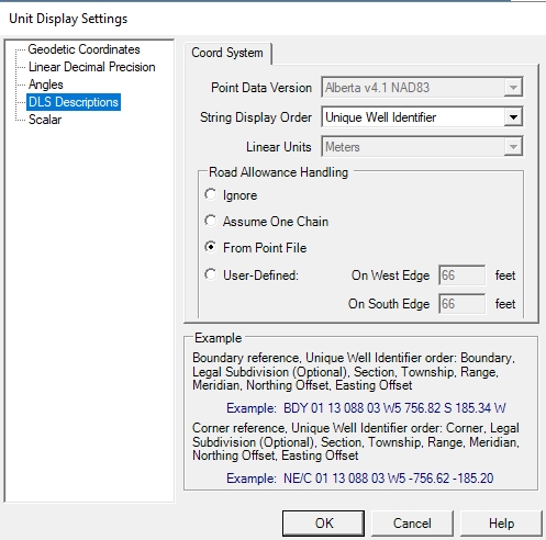
Point Data Version: The Geographic
Calculator currently allows for conversion to and from any of the standard
ATS versions from version 2.1 through version 4.1, if you have the appropriate
shift files. The files for ATS version 4.1 are available for download
from the Blue Marble website. Download and
run ATS4.1ShiftFiles.exe to automatically
install the shift files in the default data path. Earlier versions of
ATS must be obtained from another source, and placed in the Geographic
Calculator data path.
The default datasource location for DLS (Saskatchewan, Manitoba) or ATS
shiftfiles is:
C:\Program Files\Blue Marble Geo\Geographic Calculator\Data\shiftfiles
or
C:\Program Files (x86)\Blue Marble Geo\Geographic Calculator\Data\shiftfiles
This location can be changed in the Preferences
> File Locations dialog. Shift files from earlier ATS versions are
available from AltaLIS at http://www.altalis.com/contactus.html
String Display Order: There are two different orderings used for the string display order of DLS coordinates: Standard Survey and Unique Well Identifier. The example area below the selection fields will display descriptions and examples of the currently chosen ordering.
Linear Units: Offsets from the Section Corners or Section Boundaries can be measured in either International Feet or Meters.
Road Allowance Handling: This area allows you to specify how to calculate the road allowance between sections. You can select to use no road allowances, one chain for all road allowances, or the allowances specified in the DLS point file. You also have the option of defining custom road allowances.
Scalar
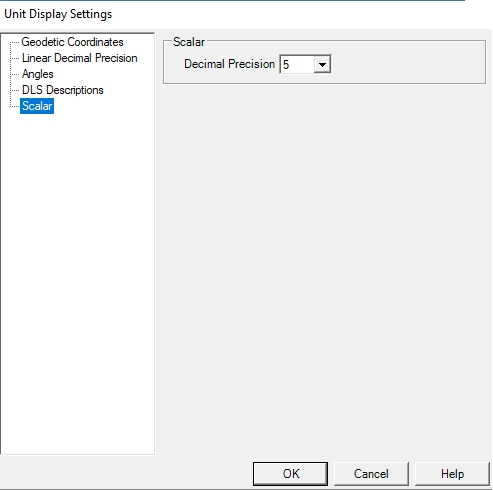
Specify the decimal precision used when displaying scale values.