 Display Statistics for Selected Lidar/Calculate Lidar Statistics in Selected Area features
Statistics for lidar can be generated either for points that have been selected with the digitizer tool, or selected via an area feature. Both Display Statistics for Selected Lidar and Calculate Lidar Stats in Selected Area features function similarly as described here for the respective subsets.
Area features used to select lidar features will inherit these statistics as attributes.
Visualization of some of these statistics can be found in the layer's metadata tab under Histograms.
These options are found in multiple places, after selecting the points:
- In the Digitizer Toolset, choose the icon in the Information section
- In the Digitizer Menu, or right-click context menu, under Analysis/Measurement
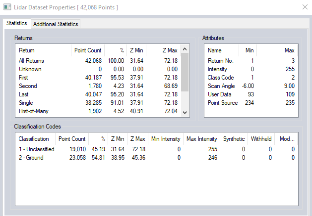
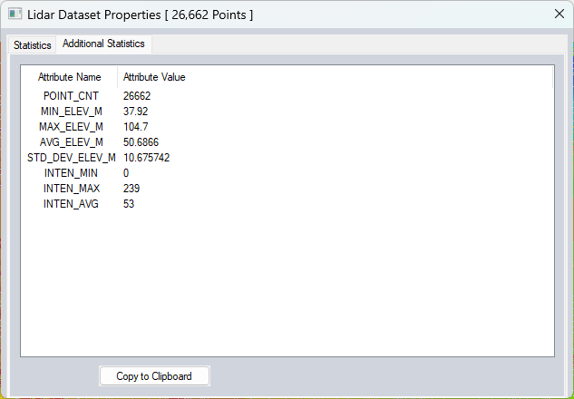
There are 2 tabs in the Lidar Dataset Properties window: Statistics , and Additional Statistics.
The statistics tab of the dialog displays a summary of the Attributes, Return counts, and Classification Codes.
The Additional Statistics tab displays area statistics. When calculated from selected points without an area feature, the bounds of the selected points are used.
Scripting Reference
CALC_LIDAR_STATS parameter for the EDIT_VECTOR command.