XYZ Grid
The Export XYZ Grid command allows the user to export any loaded elevation grid data sets to a comma-delimited ASCII XYZ file. Each grid point will be represented as follows (actual coordinate delimiter is configurable):
When selected,
the command displays the XYZ Grid Export Options dialog (below) which
allows the user to setup the export. The dialog consists of a General
options panel which allows the user to set up the grid spacing and vertical
units, a Gridding panel, and an Export Bounds panel which allows the user
to set up the portion of the loaded data they wish to export.
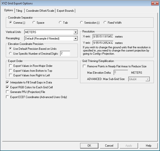
Coordinate Separator - Select delimiter
type to separate coordinate values.
Vertical Units - Specify the Vertical
Units to be used for the grid export.
Use the Resampling section to select
a resampling method (if applicable) to be used in generating the exported
grid. The Elevation Coordinate Precision
can be used to set specify decimal precision, if different from default/native
units. The X or Y axis resolution can be manually specified in the Resolution section, the units can
be edited in the Configure Projection dialogue.
The Grid Thinning/Simplification
options can be used to thin and simplify dense grids. Use Remove
Points in Nearly Flat Areas to Reduce Size if your data contains
flat areas that you require only a few points to represent, hilly areas
you will get denser points so that the terrain is represented with a minimum
number of points overall. Once this option is selected, you may specify
a maximum sub-grid size, and the export will break the grid into blocks
that are 4x4, 8x8, 16x16, 32x32, 64x64, 128x128, 256x256 or 512x512. With
everything in a block within a specified elevation range, you will get
a single central point for the block. If the range is too large, then
that 64x64 block (for example) would get broken in to 4 32x32 blocks and
the process repeated.