Spatial Database Connection Manager
The Spatial Database Connection Manager allows you to create and save enterprise spatial database connection definitions. Once a connection has been defined, you can use it when importing and exporting spatial database tables. These connection definitions can be used with the following spatial database:
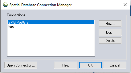
The Connections area contains a list of existing connections. To create a new connection, click the New... button. Global Mapper will display the Define Spatial Database Connection Dialog, which can be used to specify the connection parameters for the new connection.
To update an existing connection definition, select it in the Connections list and click the Edit... button. Global Mapper will display the Define Spatial Database Connection Dialog, which can be used to update the connection parameters for the selected connection.
To delete an existing connection, select it in the Connections list, and click the Delete button.
Click the Open Connection... button to open the currently selected connection and load data into Global Mapper.
When you have made all of your changes to the spatial database connections, click the OK button to store the new definitions.
The Cancel button quits the process of changing spatial database connection definitions.
The Help button displays the Global Mapper help for this dialog.