 Sky View
![]() This tool requires Global Mapper Pro.
This tool requires Global Mapper Pro.
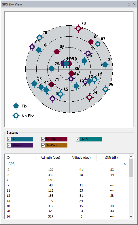
This option will open the Sky View dialog to view the satellites connected to the current GPS device. The Sky View map displays the satellites within range based on their location, with those to the north at the top of the screen. Those closer to the center of the map have a higher altitude on the horizon. Satellites not being used for location (that have a low signal to noise ratio) appear as hollow circles while satellites with a stronger signal are shown with a filled symbol.
Use the check boxes in the Systems section to filter the displayed satellites by constellation.
Below the map the displayed satellites are listed with the ID used to label the symbol on the Sky View map, the azimuth, altitude, and signal-to-noise ratio (SNR).
The Sky View window can be floating, or docked inside the main application. For more information see Window Docking