Connecting to a PostGIS Database
PostGIS adds spatial capabilities to PostgreSQL databases. Global Mapper can connect to a PostGIS database as long as the proper connection information is provided to establish the connection. See the below example for setting up a connection to a PostGIS database and importing data to into Global Mapper from that database connection.
Establishing a Connection to a PostGIS Database
-
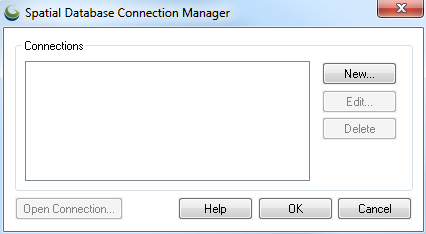
Open the Spatial Database Connection Manager. This can be found in the Tools Menu. Once open, select New.
-
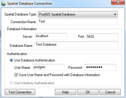
In the resulting Spatial Database Connection window, the parameters will need to be updated for the specified connection. The Spatial Database Type needs to be set to PostGIS. The Connection Name is one used locally in Global Mapper and can be of your choosing. Enter the Server and Port used to access the database. The database’s name is entered in the Database Name field. This, along with the User Name and Password needed to access the database are required. The log-in information can be saved for future use.
-
Complete this form by choosing OK. The new connection will now show in the Spatial Database Connection Manager.
Importing Data from a PostGIS Database
-
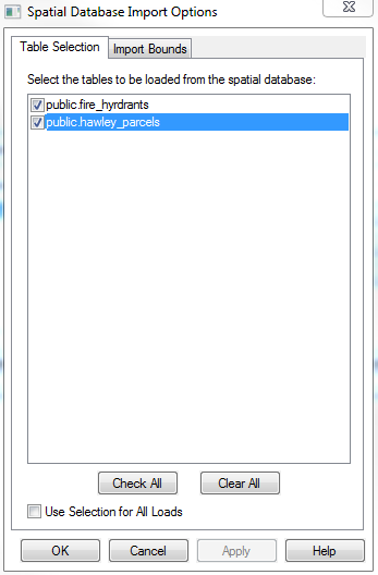
Choose Open Connection in the Spatial Database Connection Manager to bring up the Spatial Database Import Options window, allowing you to select which tables to load from the database into Global Mapper.
-
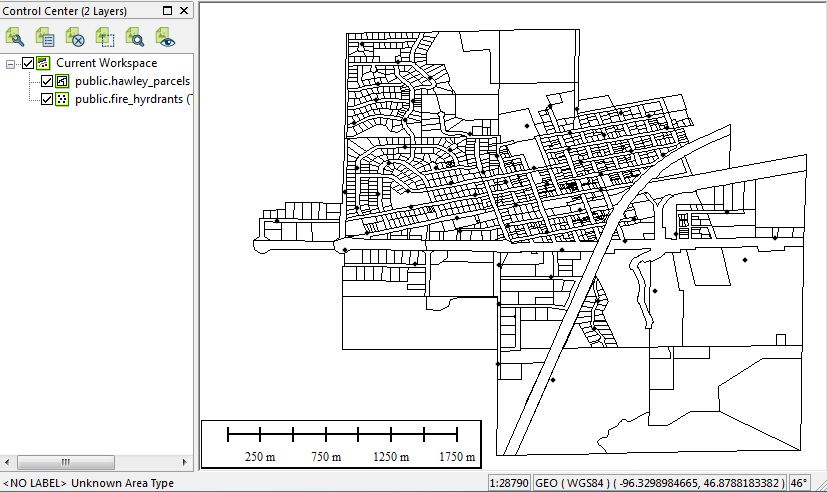
Each table will now display as an individual vector layer within Global Mapper.