Find Overlap Between Lidar/Raster/Terrain Layers
The Find Overlap Between Lidar/Raster/Terrain Layers tool can be
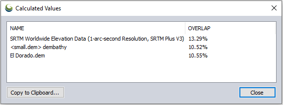
accessed from the Analysis menu. This tool generates a report showing the percent overlap between layers and can creates a new raster layer showing the areas of overlap.
Selecting this option will open the 'Select Layers' dialog, here all loaded Lidar/point cloud, raster and gridded terrain layers will populate in a list. Select those you would like to find overlap between.
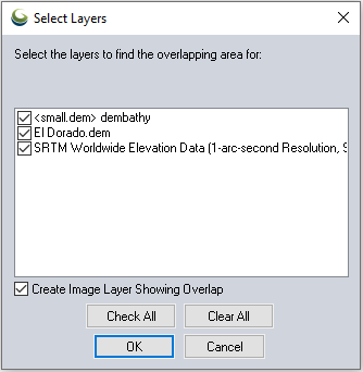
The Create Image Layer Showing Overlap option will generate a raster layer shading the area of overlap area of all the selected layers.
Once the desired layers are selected click OK to generate the overlap report and optional overlap layer.