The Count Overlapping Raster/Terrain/View Shed Layers report can be
accessed from the Analysis menu. This
creates a new grid layer that counts how many of another selected list
of layers have valid samples at each location. This option can be used
to count coverage of view shed layers where they overlap, or where View
Shed and Terrain and Raster Layers overlap.
Selecting this option will open the 'Select Layers' dialog, here all loaded
Raster, Terrain and View Shed Layers will populate in a list. Select those
you would like included in the count. 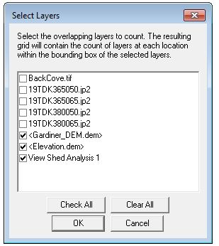
Once you have the desired layers selected, select 'OK' to generate a new
grid layer called 'Count of Layers', this layer will appear in the Overlay
Control Center and in the project map interface. Once the new Grid Layer
is Created, use the Feature Info Tool to click on the map and get a Count
of Layers for locations.
In the example below the Feature Info Tool
has been used to click on a pixel in the red area of the 'Count of Layers'
area, which signifies a count of 3 overlapping layers. ![]()