Create Volumetric 3D Mesh Buffer Features
|
|
This tool requires Global Mapper Pro |
These Advanced Feature Creation options generate Cylindrical, Pipe, or Spherical buffer 3D mesh features around a selected feature at a measures distance.
Find these tools by selecting the vector feature in the workspace, the choosing the tool from the Digitizer menu or from the Advanced Feature Creation options in the right-click menu.
 Create
Buffer Around Selected Feature(s) option from the Digitizer (Edit) toolbar, or the Digitizer menu, or context menu under Advanced Feature
Creation.
Create
Buffer Around Selected Feature(s) option from the Digitizer (Edit) toolbar, or the Digitizer menu, or context menu under Advanced Feature
Creation. The style for the generated mesh features, including color and transparency, can be set in the buffer creation dialogs and later altered with the Digitizer.
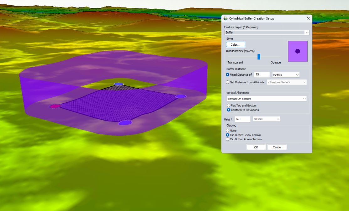
Cylindrical Buffer
Created from any selected point, line, or area feature(s), a cylindrical buffer calculates a 2D buffer area, and then extrudes it to the specified height. For point features this will create a vertically oriented cylinder. Add elevation values to the input vector features before using this tool to create a mesh vertically placed in relation to the source vector feature.
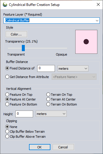
Feature Layer - Enter or select a layer for the generated buffer feature(s).
Buffer Distance - specify either
a Fixed Distance, or to get distance values from an attribute field of
a loaded data layer.
Vertical Alignment- determine the placement of the buffer relative to the selected 3D source feature or the terrain. The options available will create the mesh with the feature or terrain sitting on top, centered vertically on, or with the feature or the terrain at the bottom of the mesh.
- Flat Top and Bottom: Cylinder will have a flat top and bottom, and will be placed so that mid elevation of feature or enclosed terrain will be on top, center, or bottom.
- Conform to Elevations: Cylinder top and bottom will follow feature or terrain elevations.
Height- specify the height to which the generated buffer will be extruded.
Clipping provides the option to crop the generated mesh where it intersects with the terrain:
- None: will not clip the generated mesh buffer.
- Clip Buffer Above Terrain: will remove the section of the mesh above the terrain surface.
- Clip Buffer Below Terrain: will remove the section of the mesh generated below the terrain surface.
Pipe Buffer
Created from a selected line feature, a pipe buffer creates a pipe measuring the specified distance perpendicular to the line segment. If the input line feature has elevation values the generated mesh will be placed vertically based on those values, otherwise the feature will be anchored to 0 elevation.
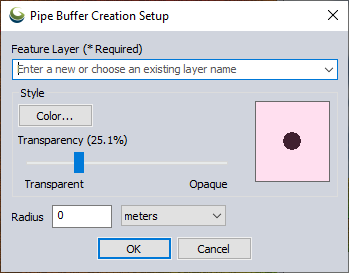
Feature Layer - Enter or select a layer for the generated buffer feature(s).
The Radius is the buffer distance for the generated mesh buffer. This is the distance perpendicular from the selected line to the wall of the generated mesh feature.
Spherical Buffer
Created from a selected point feature, a spherical buffer creates a sphere with the radius measured outwards from the input point. The created mesh can be clipped to the terrain.
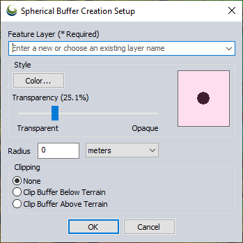
Feature Layer - Enter or select a layer for the generated buffer feature(s).
The Radius is the buffer distance for the generated spherical buffer. This is the buffer distance from the selected point to any location on the generated mesh feature.
Clipping provides the option to crop the generated mesh where it intersects with the terrain. The option None will not clip the generated mesh buffer, Clip Buffer Above Terrain will remove the section of the mesh above the terrain surface, and Clip Buffer Below Terrain will remove the section of the mesh generated below the terrain surface.