The Create Area Features from Equal Values tool allows for raster to vector or elevation grid to vector conversion of data based on the pixel values. For imagery this may be RGB values or palette indices. For elevation data, this is elevation values, slope values, or slope direction values.
This tool is available from the Layer menu, or by right clicking on an image or elevation layer in the Control Center and choosing Create Area Features From Equal Values in Selected Layer in the Layer sub menu.
Note: Data downloaded from online sources must first be exported and reloaded from file before using this tool.
Options
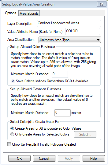
Layer Description defines the resulting layer name.
Value Attribute Name specifies the name of the attribute where the pixel value will be copied for the resulting vector features. When working with raster image data the default value COLOR will be used. When considering terrain data the active shader will determine the value of either ELEVATION, SLOPE, or SLOPE DIRECTION. Leave this value blank to not create an attribute containing the raster pixel value.
Area Classification specifies the feature type of the resulting vector features.
Set up Allowed Color Fuzziness
For imagery data, this section specifies how to group RGB values into area features. Based on the 8-bit color range of values, specify the range of shades to include above and below the given color value.
Check the Save Palette Indices Rather than RGB if Available to create attribute values with the palette index number rather than RGB.
Set up Allowed Elevation/Slope/Slope Direction Fuzziness
For elevation data, specify the match distance to group elevation values by. Like with color fuzziness this value is measured above and below output attribute value. For example match distance of 10 would generate elevation areas with a 20 meter elevation range and an attribute specifying the middle value of the elevation range.
Select Color(s) to Create Areas For
Create Areas for All Encountered Color Values will create area features for the entire image area. Use this setting with caution with standard images, as it can take a while to run. It is recommended to test this first on a smaller area using the Draw a Box option on the Area Bounds tab.
Only Create Areas for Selected Colors creates area features for only color choosing using the select button, and including any nearby shades in the Maximum Match Distance. For extracting vector features from imagery, this is the recommended setting for files that have many shades of colors. Use the select button to specify the color to extract.
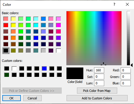
Determine the approximate RGB value in the image first by mousing over it with the cursor and viewing the value in the bottom bar, using the Pick Color from Map option on the Color dialog, or first calculate the color statistics within a selected area.
Examples
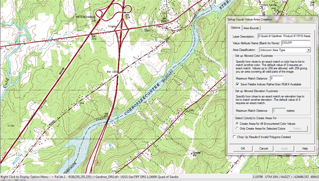
Imagery
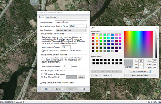
This image is set to create area features from the gray pixels in the image. The average RGB values of the road were determined, and then specified in the color picker. A maximum match distance has also been set.
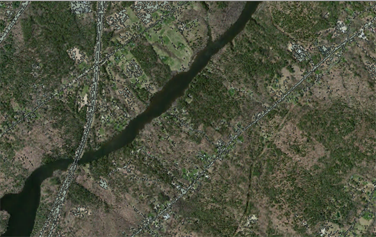
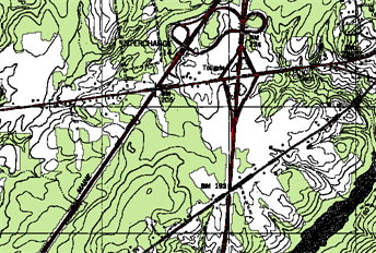
The result is area features tracing the pixel values that matched the color criteria. This initial result can be improved through further digitizer tools to reshape and combine the areas. Suggested further steps include using Simplify and Smooth tools to reshape the feature. Other useful steps may be Select
All Area/Island Smaller than Size… to delete smaller areas that were incorrectly selected, or Skeleton Lines to convert the areas to line features.
Palette Image
The above image is a palette image. Since there are only specific colors in the palette, areas can be created for all encountered values with a Maximum match distance of 0. To extract only certain features such as the river, roads or contour lines, choose to create for only the selected palette color.
Further digitizer tools can be used to combine and reshape the resulting vectors. They can also be split into separate layers based on the COLOR attribute.
Elevation Values
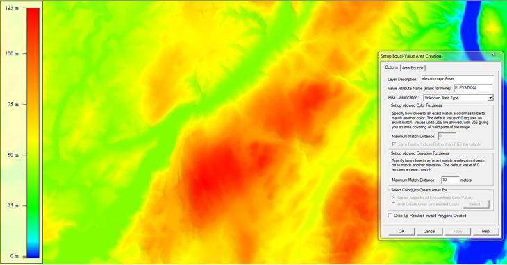
The above elevation grid is run with a Maximum Match Distance of 10 meters
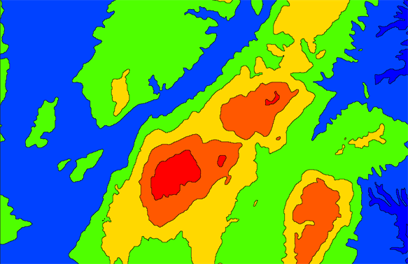
The resulting area features inherit the colors of the elevation grid, and represent elevation ares in 20 meter ranges.
Slope Values
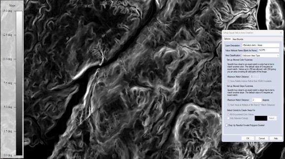
The above slope grid is run with a Maximum Match Distance of 2 degrees.
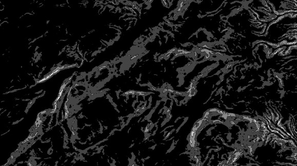
The resulting area features inherit the colors of the slope grid, and represent slope areas in 2 degree ranges
Slope Direction Values
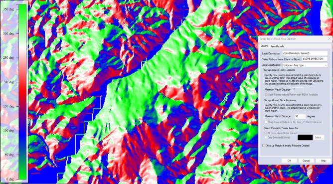
The above elevation grid is run with a Maximum Match Distance of 30 degrees.
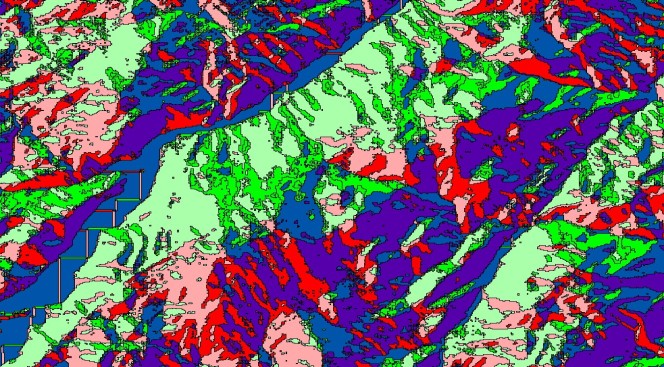
The resulting area features inherit the colors of the slope direction grid, and represent slope direction areas in 30 degree ranges.