Distance Scale Display Configuration
This Distance Scale section of the Display Configuration allows for the control of a distance scale displayed on the main map when data is loaded.
Access the Distance Scale Display Configuration by selecting the  Configuration button from the File Toolbar or Tools menu, and navigating to the Distance Scale section in the Display Options folder. This panel is also accessible from the View menu > Workspace Layout Options> Distance Scale... These can be access directly by right-clicking on the distance scale element on the map display.
The units used in the distance scale are controlled by the Distance Measure Units in Measure/ Units section of Configuration.
To add a distance scale or distance representative fraction to maps for print or PDF, see the Map Layout Editor.
To control the distance scale display with multiple 2D map views, see the Map View Manager.
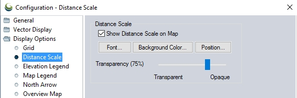
Show Distance Scale on Map
When checked, the distance scale will be displayed in the main map window.
Customize the font used in the element.
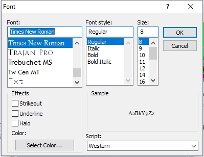
Use the font dialog to specify the desired font. A preview will display in the Sample area of the dialog.
Font
Select the font to use for the text. The list will populate with available system fonts. See also Labels Configuration for default font face and character set.
Effects
Specify text effects, including a halo around the text, a specific font color, or strikeout and underline effects.
Script
Specify the script to use for the text. The available options are dependent on the selected font.
Background Color...
Customize the background color of the element.
Specify where in the map frame the element will be displayed.
Size on Map View - The element can be set as a percentage of the view width, or preserved at the original pixel size.
Horizontal Position - Position the element horizontally by specifying a distance away from the left or right edge, or from the center.
Vertical Position - Position the element vertically by specifying a distance away from the top, bottom, or center.
Transparency
Use the slider to control the opacity of the element.