The following tools are available to transform a 3D model into another data type.
 Create Elevation
Grid from 3D Vector Data
Create Elevation
Grid from 3D Vector Data
Use this tool to convert a mesh feature into an elevation grid.
Create 3D Area from 3D Model(s)...
This tool is available in the Control center. Right-click on a mesh layer(s) and navigate to the Layer sub-menu to find this option.
This tool will convert 3D models into area features. The area features produced will obtain the feature type
Create Image Layer from 3D Model(s)...
This tool is available in the Control center. Right-click on a mesh layer(s) and navigate to the Layer sub-menu to find this option.
For 3D models that contain a texture, this tool will convert the applied texture into an orthoimage.
Example
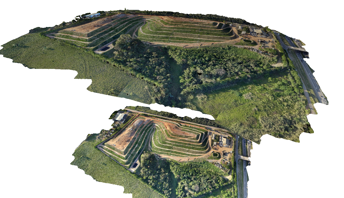
This example of the 3D Viewer shows a 3D Mesh (created from Pixels to Points®) on top, with the orthoimage that has been created from the mesh underneath it.
To save the mesh texture as an image see Mesh Feature Style.
Create Point Cloud from 3D Model(s)...
This tool is available in the Control Center. Right-click on a mesh layer(s) and navigate to the Layer sub-menu to find this option.
This option will convert a 3D model into a point cloud by including the vertices, and sampling the faces. This point cloud output can then be classified, converted to an elevation grid, etc. to create different terrain and lidar products.
Example
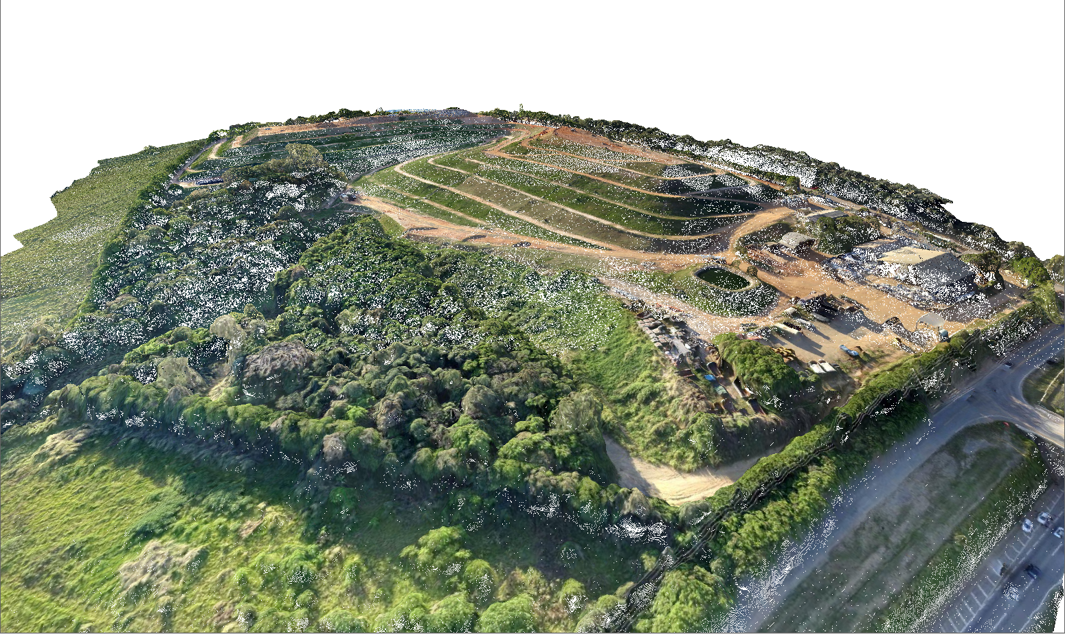
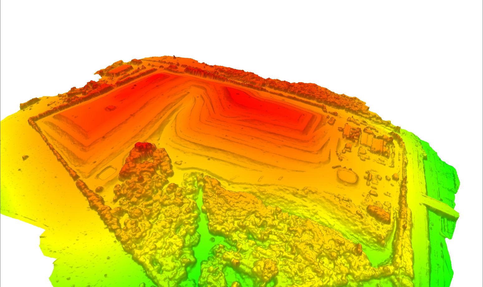
This example shows a point cloud generated from a mesh (3D Model produced by Pixels to Points®). The second image shows the point cloud gridded into a terrain surface using the Create Elevation Grid from 3D Vector Data tool.
Create 3D Model / Mesh
The following tools are available to create a 3D Model for other input data.
Create Mesh Feature from Terrain...
This tool is available in the Control center. Right-click on a terrain layer(s) and navigate to the Layer sub-menu to find this option. It can also include imagery layers.
This option will triangulate the terrain grid into a mesh feature. Each pixel specified will be converted to two triangles.
If a raster image is also selected in the layer dialog, the image layer will be applied as a texture image. If no image is selected the texture for the generated mesh will be created from the currently active elevation shader.
For more information see Create Mesh from Terrain.
Create 3D Model from Selected Area Feature(s)
This option is available in the Digitizer menu under Advanced Feature Creation.
This will divide area features into triangles so that they can be represented as mesh features.
Export
3D model/mesh feature can be exported to a 3D Format, a Vector Format, or a Raster Format. An export to a 3D format will retain the 3D nature of the data and may retain the texture. Vector formats can retain the 3D structure of the data but will not export the texture. Exporting to a raster image format will export a picture of the mesh as it is seen in the 2D main view.
See Also:
- Pixels to Points®
- Create Mesh from Selected Lidar
- Create Elevation Grid from 3D Vector Data with the Save TIN vector layer option
- Mesh Feature Style