|
|
This tool requires Global Mapper Pro |
If Global Mapper Pro is registered, and lidar data is currently loaded, the Lidar Toolbar will populate on the
Path Profile/ Line of Sight window. Note that while this tool specifies lidar, it also works with other loaded point clouds such as photogrametrically generated.


Tools for editing lidar from Path Profile
To reclassify points using the Path Profile tool and the Manual Classification tool, select the points to reclassify within the Path Profile/ Line of Sight window.
Points can be selected with various selection tools:
 Select Lidar - Drag a box to select lidar points.
 Select Lidar by Polygon - Left click to trace a polygon around a set of points. Right click to complete the selection.
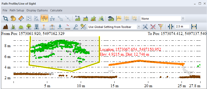
 Select Lidar Above Line - Left-click on the profile window to place points, then right-click to complete the line. All points above the line (in the shaded area) will be selected.
 Select Lidar Below Line - Left-click on the profile window to place points, then right-click to complete the line. All points below the line (in the shaded area) will be selected.
Select the new class button on the
Lidar Manual Classification toolbar to reclassify the selected points. Class definitions can be found on the Manual Classification tool page. 
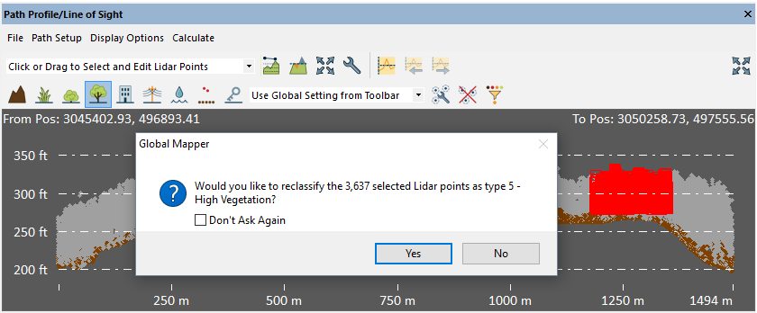
A window will pop-up verifying that selected points are to be reclassified to the indicated class. To finish reclassification, click the 'Yes' button.
Keyboard Shortcuts: keys 0 - 9 are shortcuts to automatically reclassify points selected in the profile window.
- 0 - Created, never classified
- 1 - Unclassified
- 2 - Ground
- 3 - Low Vegetation
- 4 - Medium Vegetation
- 5 - High Vegetation
- 6 - Building
- 7 - Low Point (Noise)
- 8 - Model Key-point (mass point)
- 9 - Water
Color Mode Drop Down
The Lidar toolbar Path Profile/ Line of Sight window
also features the drop down menu to select the
display characteristics of the point cloud.
By default, this will be set to Use Global
Setting from Toolbar, which copies the lidar point display characteristics
from the primary Global Mapper interface set in the Lidar Toolbar.
In the Path Profile window, the color settings
may be changed in just the context of the Path Profile window. For more information on the available draw modes, see Lidar Draw Mode (Color By...) .
Delete Selected
Delete the selected Lidar points.
Edit Selected
Edit the selected Lidar points. This allows for specifying Lidar classes or properties that are not available in the toolbar buttons or keyboard shortcuts.
Adjust Lidar Corridor Width
Use the Increase and Decrease Corridor Width buttons to adjust how wide of a swath of points around the path profile are being displayed. The increment that this adjustment is made can be specified in the display tab within the Path Profile Settings.