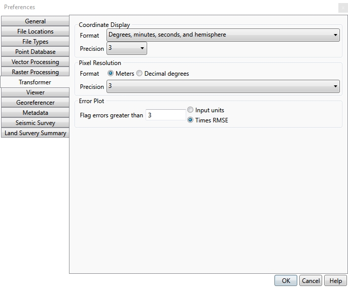
Transformer Preferences
The Transformer preferences tab contains formatting information for the Raster Transform and Georeferencing portions of the Geographic Calculator.

Coordinate Display
The Coordinate Display controls the formatting of Central Latitude on Raster Transform jobs. The options are:
Format:
- Signed Degrees - (-)DD.ddddd
- Degrees and Hemisphere - HDD.ddd (where H represents the hemisphere of the coordinate [N,S,E,W])
- Signed degrees and minutes - (-)DD MM.mmmm
- Degrees, minutes and hemisphere - HDD MM.mmmm
- Signed Degrees, minutes and seconds - (-)DD MM SS.sss
- Degrees, minutes, seconds and hemisphere - HDD MM SS.sss
Precision: This is the number of decimals displayed when formatting spherical coordinate, and grid coordinates (specifically the Central Latitude value on Raster Transform jobs).
Pixel Resolution
These settings relate to the pixel resolution values listed in the output settings of Raster Transform jobs.
If the output pixel resolution is auto-calculated, the auto-calculated value maintains the same resolution as the input data (in the x-direction at the central latitude).
Format is the unit used to display the output resolution of the transformed image when the target coordinate system is geodetic (latitude/longitude). If this is set to Meters, the auto-calculated value is based on a simple cylindrical model that is used during the reprojection process, and relies on the central latitude attached to the current transform job.
Precision is the number of decimals displayed in the pixel resolution.
Error Plot
This is the metric used to characterize points in the Georeferencer in the Geographic Calculator. When georeferencing is applied to a raster image, a polynomial map is created to relate ground control points to pixel values. If the polynomial mapping cannot create a relationship between the pixel location and the ground control with less than this specified error value, it will be marked as a suspect control point in the referencing grid.