Calculating Inverse in Interactive Conversions
An Inverse calculation computes the distance between two known coordinates
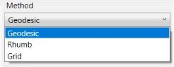
on the same datum. The result may be calculated using Geodesic![]() Geodesic distance is the shortest possible line between two points on the surface of the datum. This is also referred to as Great Circle distance.
It is the shortest distance between two points along the surface of the ellipsoid.,
Rhumb
Geodesic distance is the shortest possible line between two points on the surface of the datum. This is also referred to as Great Circle distance.
It is the shortest distance between two points along the surface of the ellipsoid.,
Rhumb![]() A Rhumb Line is a line of constant bearing. Rhumb line distance measures the distance between two points maintaining a line of constant bearing relative to true north.
Rhumb Lines are frequently used to plot navigation lines., or Grid
A Rhumb Line is a line of constant bearing. Rhumb line distance measures the distance between two points maintaining a line of constant bearing relative to true north.
Rhumb Lines are frequently used to plot navigation lines., or Grid![]() Grid distance measures the distance following a straight line between two points in grid space. methods. Both the source and destination points must
be referenced to the same geodetic datum.
Grid distance measures the distance following a straight line between two points in grid space. methods. Both the source and destination points must
be referenced to the same geodetic datum.
Note: For both Forward and Inverse conversions, when height values are entered, the distance is scaled to a height above the ellipsoid. For more information see Height Above Ellipsoid (HAE) Calculations
This is also true for Geocentric coordinate systems that are 3 dimensional by nature. 3D Cartesian coordinates will be reduced to the surface of the datum. To perform an interactive inverse conversion between any two coordinate system definitions based on the same geodetic datum:
-
At the bottom of the Interactive Job, select the Inverse radio button.

-
Select a coordinate system for the first coordinate (starting location).
-
Use the Format button to select the display format for your first coordinate. This is very important for angular units.
-
Select a coordinate system for the second coordinate (ending location).
-
Use the Format button to select the display format for your second coordinate. This is very important for angular units.
-
Enter the first coordinate (starting location) into the appropriate Coordinate Point fields.
-
Enter the second coordinate (ending location) into the appropriate Coordinate Point fields.
-
Select a method for calculating the inverse, Geodesic, Rhumb, or Grid.
Note: The Grid method will only be available if the conversion is for a Projected system.
-
Ensure that the Operation Direction is appropriate for the calculation direction, going from the first coordinate side to the second coordinate side. To change the direction of the calculation, choose either 'Left To Right' or 'Right To Left; in the Operation Direction field.

-
Click the Calculate button. The Distance and Azimuth between the two points will be shown in the middle area between the starting and ending coordinate.