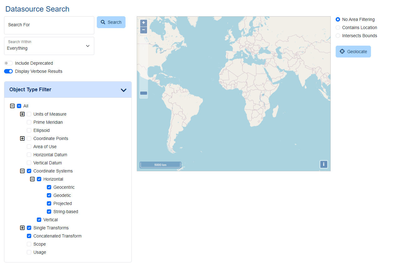
Search
The Search page allows users to query the Geographic Calculator geodetic Datasource to view details of coordinate systems, transformations, and other object definitions. The Datasource is one of the largest and most comprehensive of its kind in the industry; use the provided filters to narrow your search results.
The search results can be filtered by text search in the left sidebar and/or the map search in the center of the screen. In mobile view or a narrow browser window, the map search will appear below the text search.
Text-Filtered Search
The left sidebar contains the option to search by text. Type all or part of an identifying term in the Search For field.
Below the search bar are a number of optional filters that can be applied to constrain the search results.
Search Within
Use the Search Within drop-down to narrow the search to find matching text within a specified category.
Everything Search among all fields or within Names, Remarks, Geographic Areas, or Identifier Codes. Names Search within the descriptive name of the object. Remarks Search within the comments saved with the object. This may include supplementary information. Geographic Areas Search the name and descriptions of the area of use of the object. EPSG Codes Search by the EPSG Code
Codes of Issuer Search by other issuer codes. Choose the issuer from the drop-down list. Options
The following options can be toggled on or off to filter the search results.
Include Early Bound CRS Early bound coordinate reference systems are those that contain a transformation as part of the coordinate system definition. These systems can only be transformed using the transformation specified in the CRS definition. Include Deprecated Enable to include objects that have been deprecated. Deprecated EPSG objects are legacy definitions that have been superseded by new objects. Deprecated records should only be used when documenting or reversing use of the record that was made before it was declared invalid. Display Verbose Results Enable to display additional information about objects in the search results, including Datum, Unit, Min and Max Point, Area of Use, Dimensions, etc. For Early Bound Coordinate Systems, verbose results will also display the Base Coordinate System and Transform Name.
When Verbose results are off, the search will only display the Name, EPSG Code when applicable, and Remarks.
Object Type Filter
Filter the search results by object type. See Object Type Definitions for further information.
Map Search / Area Filtering
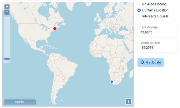
The Map Search Options filter the search results to only objects which have an Area of Use containing, intersecting, or contained by your specified location. This can be used separately from or in conjunction with the text search.
To zoom in and out, scroll the mouse wheel, pinch/spread two fingers on a touchscreen, or use the plus and minus buttons in the top left. To pan the map, click on the map with a mouse button (or tap on touchscreen) and drag the map to reposition. In desktop mode, the current cursor location will be displayed in the top right of the map window.
Contains Location
This option will return all objects that have an area of use containing the point. Click or tap on the map to specify a point, or enter a latitude and longitude in decimal degrees.
Intersects Bounds
This option will return all objects that have an area of use containing the bounding box specified by the user. Enter coordinates for the South, West, North, and East extent in Decimal Degrees, or choose the Select on Map button to specify the bounding box. Click or tap once to specify the first corner of the bounding box, then click/tap again to specify the opposite corner to complete it.
Filter by the bounds of a box drawn on the map. Objects whose area of use overlap the box will be returned. Object types with an area of use outside the drawn bounding box will be ignored by the search.
Contained By Bounds
Filter by the bounds of a box drawn on the map. Click or tap once to specify the first corner of the bounding box, then click/tap again to specify the opposite corner to complete it.
This option will return all objects whose Area of Use is completely contained within the drawn bounding box. The search will ignore object types without Areas of Use.
The Geolocate option will center the map on your current location. The web tool will prompt you for permission to access your current location information. After accepting, the map will center on your current location. A coordinate pair or bounding box is still required for filtering the search results.
Search Results
The results of the search query will display in a pop-up table organized by object type. The total number of matching objects is listed in blue at the right side of each category type.
Click or tap on an object type to show or hide the results for that category.
Specify an Items per page value to determine how many results to show for each object type. Objects that contain more matches than the page limit will show page numbers at the bottom of the results. Click the page number at the bottom of the results table to move between pages.
The Sort By Increasing Area option is available in the Search Results dialog for types of object definitions that have an area of use or usage as part of their definition, including coordinate reference systems, transformations, areas of use, and usages.
Click the object name to view the full object definition in a new tab. For more information on these definitions, see Definitions
Actions
Choose the Actions menu to perform an action with the object.
The View GML Definition and View WKT Definition options will open a new tab with the GML or WKT definition.