The Export Simple ASCII Text File command allows the user to export any loaded vector data sets (i.e. areas, lines, and points) to a delimited ASCII text file. Each vertex in an area or line and the position of each point will be represented.
When selected,
the command displays the ASCII Export Options dialog which allows the
user to setup the export. The dialog consists of an Options panel (pictured
below) and an Export Bounds panel which allows the user to set up the
portion of the loaded data they wish to export.
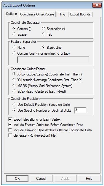
The Options tab (below) allows
the user to specify what character to use to separate the x, y, and z
coordinates of each vertex. In addition, the user can specify that they
wish to separate each vector feature with a blank line or some other custom
separator text.
The Coordinate Order section allows
the user to control the order in which the X (easting/longitude) and Y
(northing/latitude) coordinates are exported.
The Coordinate Precision section
allows you to control how many digits of precision to include with each
coordinate value. The export of elevation data is controlled with the
Export Elevations option. The Include
Feature Attributes Before Coordinate Data and
Include Drawing Style Attributes Before Coordinate Data options,
respectively, control whether or not feature attributes or feature drawing
style information is saved to the file on the lines preceding the coordinate
data for a feature.
If elevations
are being exported, Global Mapper
first looks for an elevation associated with the vertex being exported.
If no elevation is associated with the vertex, Global Mapper then checks
all loaded elevation grid data in reverse order of display to see if any
of them have an elevation at the vertex location. If so, that elevation
is used.
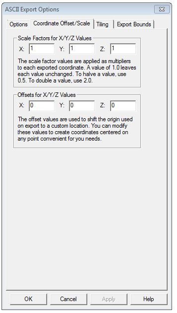
The Coordinate Offset/Scale tab (below) contains options to set Scale Factors
and Offsets for X/Y/Z coordinate values.