The Path Profile settings provide an option for viewing the selected Path Profile as a terrain cutaway in the 3D viewer. The profile included in the 3D viewer will be based on the first segment in the graphed Profile line. This tool is useful for more in-depth visual analysis for a path profile. This functionality is not currently available with Perpendicular Profile display enabled.
The 3D cutaway setting is located in the path profile window  Settings under 3D Display Options
To enable 3D cutaway, select the path profile tool.
Left click on the map at the start of the profile line, then right-click to end the profile line.
From the path profile window, open the path profile settings, and in the 3D Display Options section, specify a 3D display mode.
Optionally, check Display Path Profile Cutaway Walls in 3D to see the profile graph as a vertical wall in 3D.
Open the 3D viewer to see the cutaway.
Path Profile 3D Display Modes
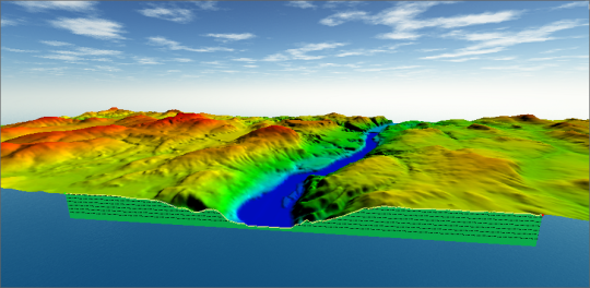
Render Single Terrain Cutaway
This cutaway view will feature a “wall” along the cutaway that shows the same basic cross section as the main Path Profile window. The wall will show the same Profile graph displayed in the Path Profile window. The profile graph will display corresponding to the terrain, and the cutaway will follow the trajectory of the first segment of the profile line.
The side of the path profile that is cutaway will adjust as the orientation of the 3D view is changed.
`
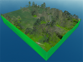
Render Four-Way Terrain Cutaway
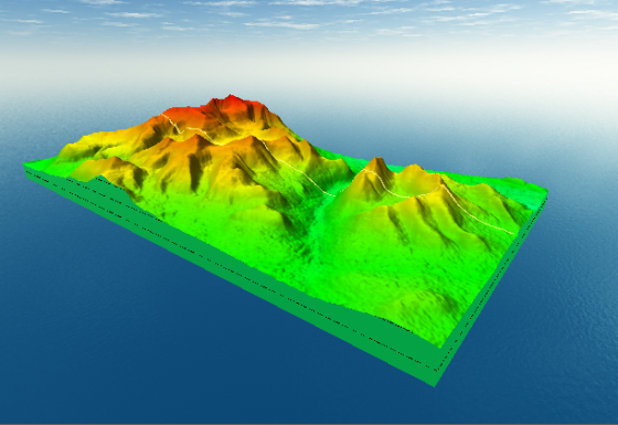
A four-way cutaway will create a rectangular extent in the 3D viewer with profile graphs on each edge. The width of the cutaway follows the length of the first line segment of the path in the Path Profile. The depth of terrain displayed in the rectangle is measured away from the path using Max Distance to Path setting in Path Profile Settings.
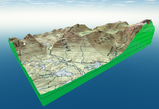
Cutaway views can also be used with draped imagery on top of the terrain or loaded 3D vector features.
Terrain Cutaways with LiDAR data
Displaying terrain cutaways requires a loaded terrain surface. If you are working with LiDAR data you can generate an Elevation grid from the ground points, or load other terrain data, such as from online source.
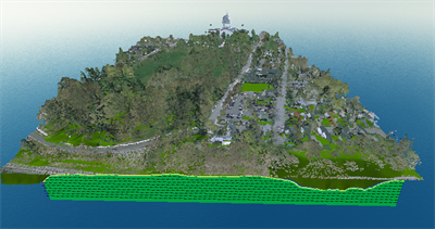
Terrain cutaway with LiDAR data